Coal and Rail in the County
The biggest post-Civil War change for the county was the installation of the railroad and the development of mining at the turn of the century. An 1881 book by civil engineer C.R. Boyd (1881) described the resources in the region. Boyd’s aim was to attract mining companies to take advantage of these resources which included “iron ores and splendid areas of almost unparalleled coal veins, with matchless timber.” The only thing lacking was accessibility to markets (Boyd 1881:213).
Boyd’s description of Lee County highlighted the lack of transportation in and out of the county. Boyd considered all of Lee County valuable to the state not only because of its boundaries but also because of the abundant resources and picturesque landscape (Boyd 1881:212). The 1860 Virginia Tennessee Rail Road bypassed Lee County, choosing to cross into Virginia at Bristol (Williams 2002: Map 3 pg. 150). Lee County was not connected by train until 1886 when the Knoxville Louisville Cumberland Railroad was built. The railroad became an essential part of the coal mining industry that began fully developing in the early twentieth century in the northern part of the county at towns like Crab Orchard (later known as KeoKee), St. Charles, and Pennington Gap, whose economy was based on mining (Figure 1).
Overall, the development of non-agricultural industries in the 1890s and early 1900s was concentrated in the northern half of Lee County. The southern region, close to the Cumberland Gap, continued to focus on and further develop agriculture. Maps from this time (Digital Commonwealth: Massachusetts Collections Online) catalog the development of Lee County’s many towns. Table 2 reveals the rapid changes between 1891 and 1895 of the communities mapped within the county. Postal route maps of Virginia and surrounding states are the key to understanding the population of Lee County at the turn of the century (Figures 5-8). An 1891 map of Lee County postal routes (Figures 5, 6 and 7) (similar in geographic region to present-day) included six mail routes that received mail two or three times a week while Jonesville and lines along the railroad and between Pattonsville in Scott County and Rose Hill received mail six times a week. The number of deliveries marked on the postal routes indicates the population growth during this time from the 1891 map (Table 2) (Figures 5, 6, and 7) (Roeser 1891) and the 1895 map. Also noted on the 1891 Post Route map is the distance between each stop was never more than thirteen miles; usually the small communities were only five or six miles apart. Only four years later in 1895 the communities marked on the post routes display no communities receiving mail less than three times a week (Table 2) (Figures 6 and 7). Additionally, the distance between towns also decreased with the largest mileage listed (10 miles) between Towell to Jonesville and from Jonesville to Milt. The presence of these small towns also marks the development of town and country mercantile stores.
|
Table 2 1891-1895 Lee County Communities (Adapted from Postal Route Maps Roeser 1891 and Von Haake 1895) |
||
|
1891Communities |
1895 Additional Communities |
|
|
Bailey Beech Spring Boone’s Path Brick Store Cany Hollow Chandler Corinth Cox Crab Orchard Cum Bow Cynthia Delphi Douglas Dryden Ely Ewing Fritts Gibson’s Station Hunter’s Gap |
Jap Jonesville Long Field Oak Glen Oak Glen Pennington Gap Pridemore Rocky Station Rose Hill Slemp Stickleyville Tide Turkey Cove Van Walnut Hill White Shoals Yocum Station Zions Mills |
Adamant Caylor Comfort Delolisar Democrat Hagan Hagan Hubbard Springs Milt Nurseries Occonita Towell |
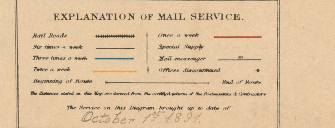
Figure 5 Postal Route Legend for Figures 5-8 (Adapted from Roeser 1891)
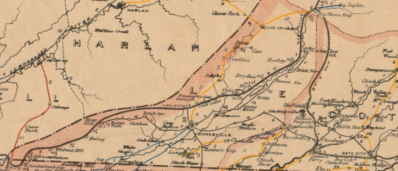
Figure 6 1891 Post route Map of Lee County, Virginia (Roeser 1891)
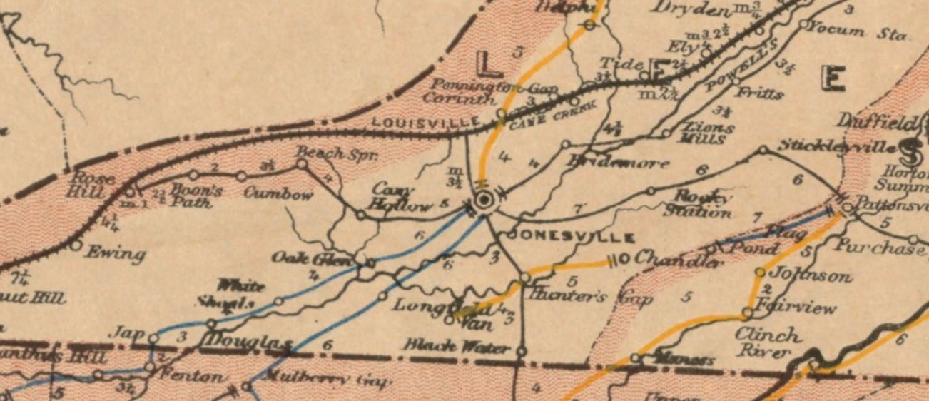
Figure 7 1891 Lee County: Post Route Map (Adapted from Roeser 1891)
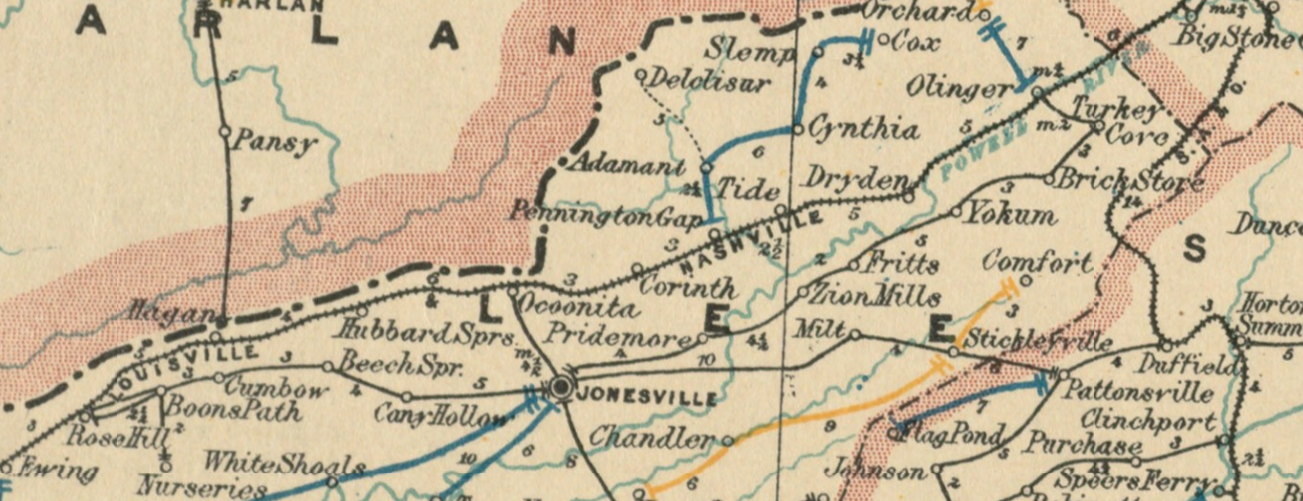
Figure 8 1895 Lee County: Post Route Map (Adapted from Von Haake 1895)
© 2017
Martha Grace Lowry Mize
ALL RIGHTS RESERVED